Two parcels appear in your search for a multifamily development site. They have the same acreage, and both seem large enough to accommodate the type of project you have in mind.
Would they support a similar number of apartments?
Acreage alone cannot answer that question. The shape of each parcel, the location of its entrances, its terrain, and the space needed for parking all influence what can fit. Those conditions also affect how efficiently buildings, circulation, and outdoor areas work together.
Site feasibility turns a parcel’s total area into a more useful understanding of its development potential. By testing layouts early, developers and architects can see where land supports the proposed project and where constraints require a different approach.
To illustrate, consider two hypothetical sites of equal acreage. Site A is a relatively flat, rectangular parcel with a straightforward street frontage. Site B has an irregular boundary, a narrower access point, and sloping terrain. These examples are illustrative; their actual capacity would depend on verified site information and tested designs.
Equal Acreage Doesn’t Mean Equal Buildable Area
The property boundary is only the starting point for site planning. Buildings must fit within the space available after applicable setbacks, easements, and other restrictions are accounted for. The overall layout must also accommodate access, parking, landscaping, and supporting infrastructure.
On Site A, the rectangular boundary might leave a continuous area for building placement.
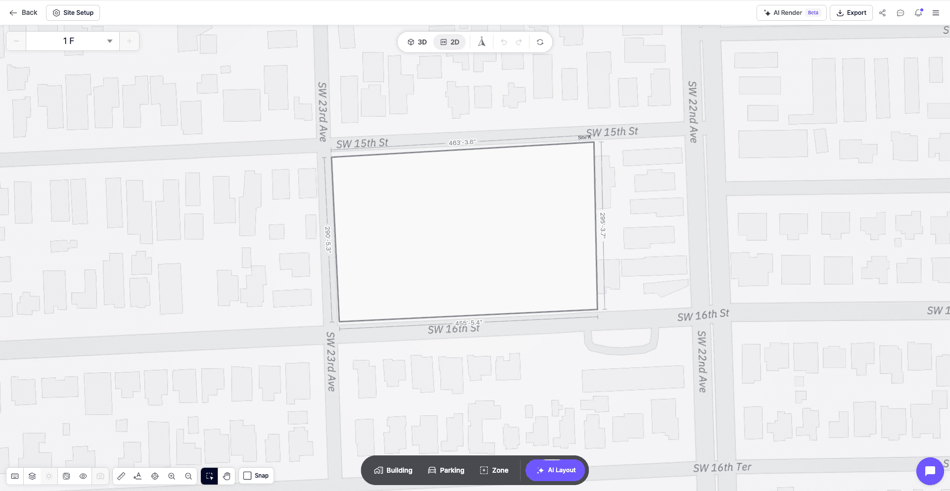
On Site B, an angled boundary or narrow section could divide the usable space into areas that are harder to organize.
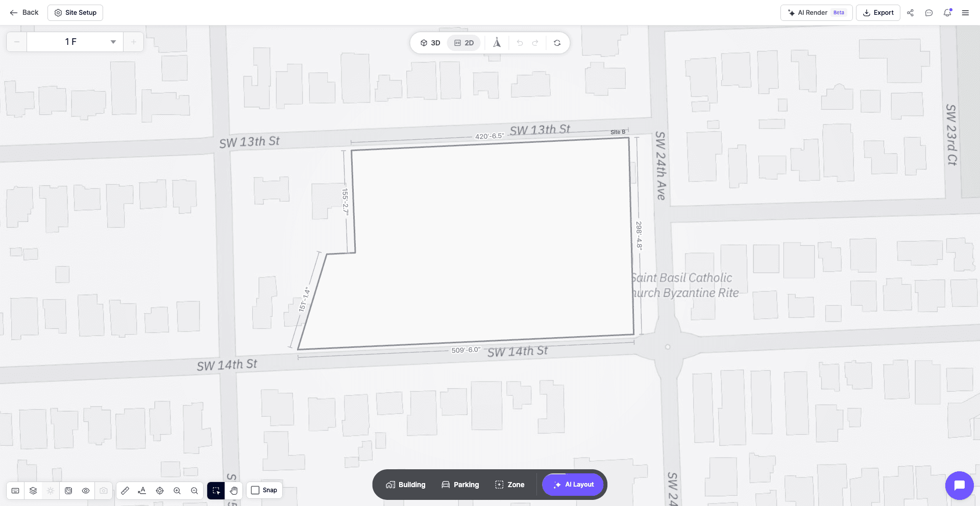
Even if the two sites have similar amounts of land remaining, that land may be distributed differently. A broad, connected area can accommodate a different building arrangement from several narrow or fragmented areas.
An early multifamily feasibility study should therefore examine both the amount of available space and its shape. This helps prevent an acreage-based estimate from becoming a unit-count expectation before a workable layout exists.
Parcel Shape Changes How Buildings Fit
A building layout that works on one parcel may need substantial changes to fit another parcel of the same size.
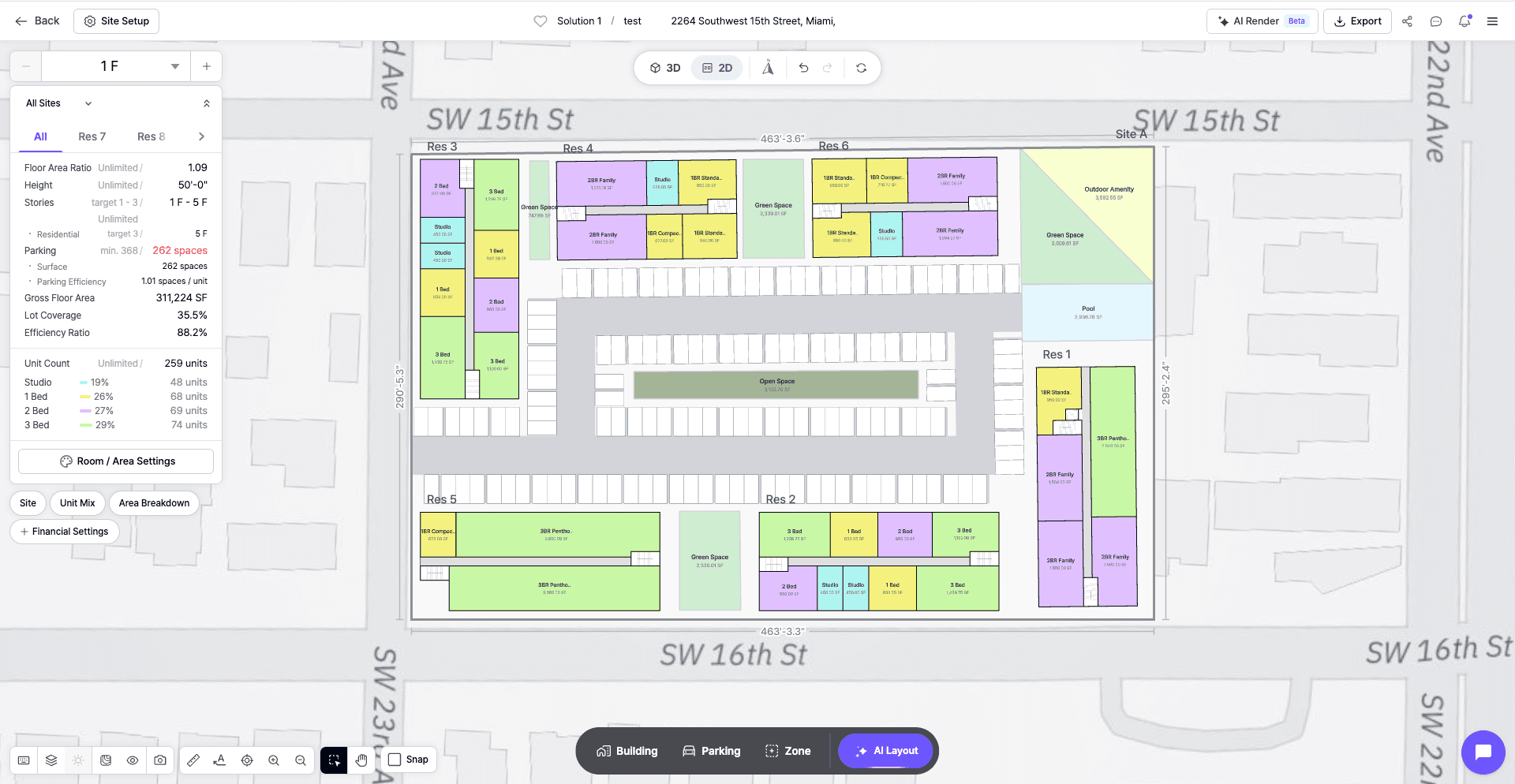
Site A could allow buildings to sit in a regular arrangement, with space between them organized into courtyards, pedestrian connections, or amenities.
On Site B, buildings may need to rotate, shorten, or change shape to respond to the boundary.
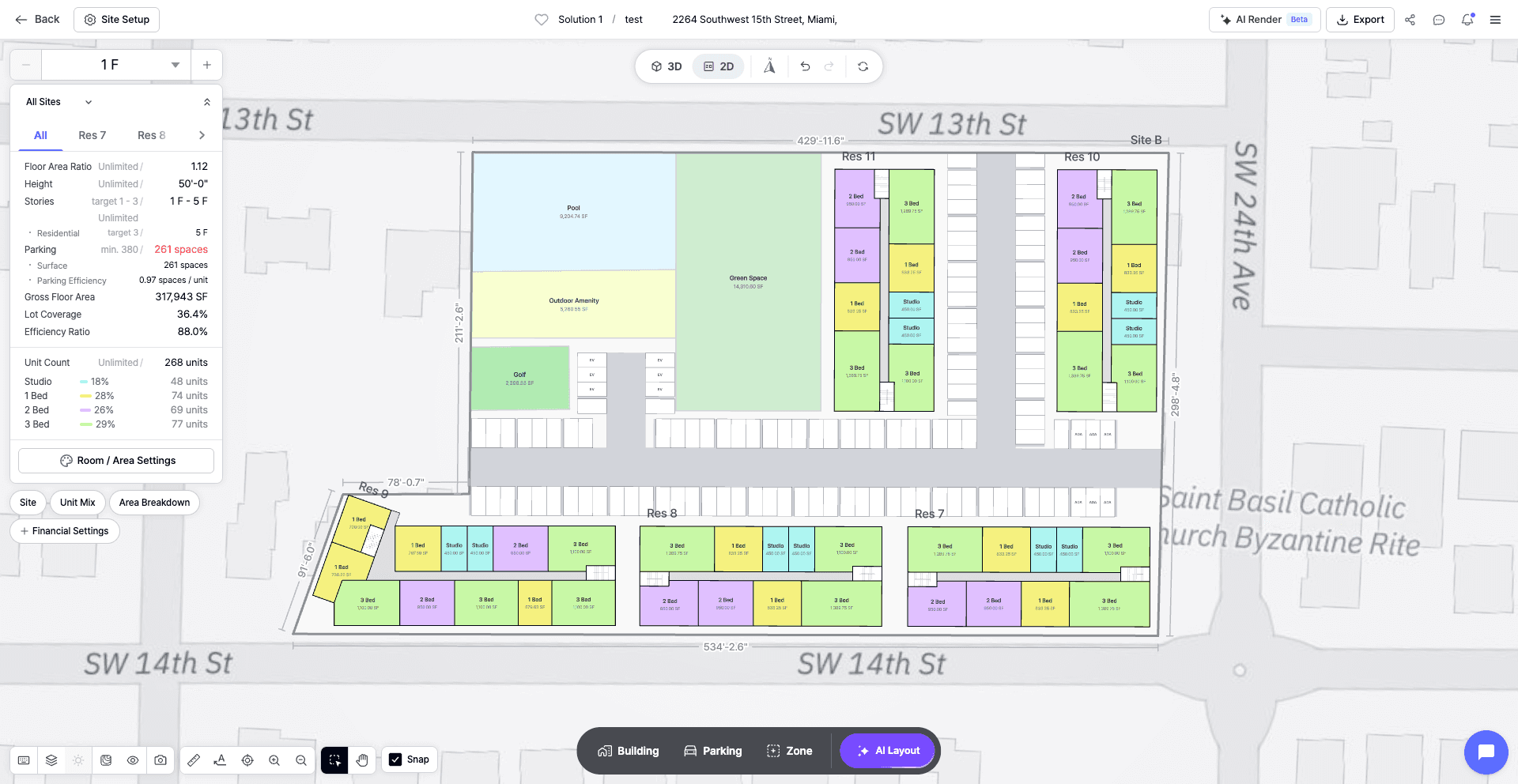
Those adjustments can affect the residential plan. Shortening a building may reduce unit count, while changing its shape may alter corridor arrangements, corner conditions, and the unit mix that fits comfortably.
Leftover land also deserves attention. A narrow strip along a boundary contributes to total acreage but may have limited value for building placement. It could still serve a useful purpose as landscaping or separation, depending on the project.
The goal is to understand how each part of the site contributes to the proposed development. A regular parcel may be easier to organize, while an irregular parcel may require a more tailored design to make effective use of its space.
Access and Parking Influence the Entire Layout
A promising building arrangement can change once vehicle access and parking are incorporated.
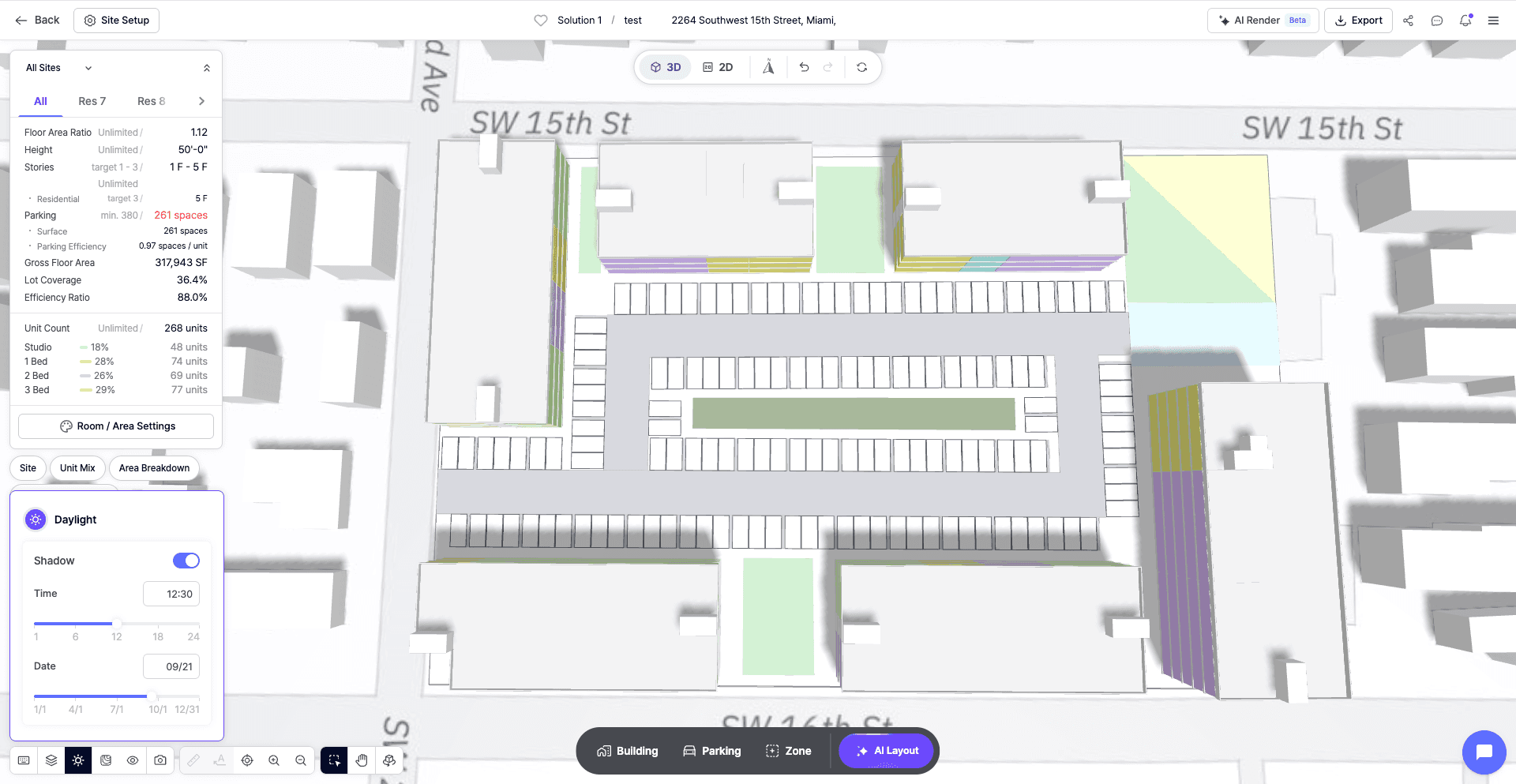
Site A’s layout includes several horizontal parking rows, with a central open-space strip between two of them.
Site B combines vertical parking rows between buildings with horizontal rows across the lower part of the parcel. This arrangement shows how parking and buildings can be organized within an irregular boundary.
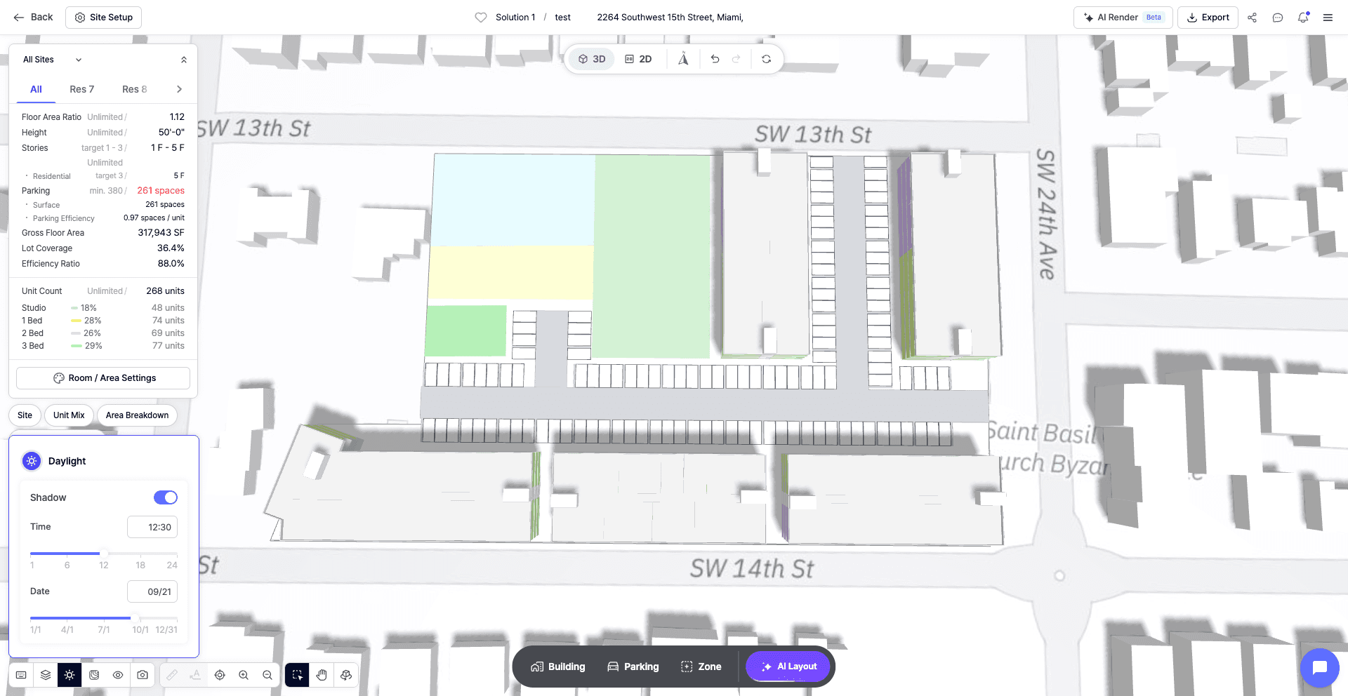
For both sites, proposed entrances and connections to the surrounding streets would need to be checked against actual access conditions and applicable requirements.
Parking also connects the residential program to the space needed on the ground. For a hypothetical 100-unit project, an assumed parking ratio of 1.5 spaces per unit would mean:
100 units × 1.5 spaces per unit = 150 parking spaces.
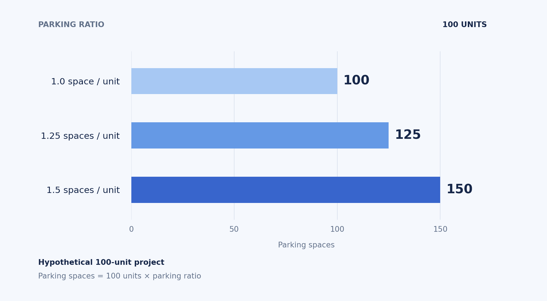
That calculation establishes a space count, not proof that the parking fits. A layout must also account for drive aisles, turning movements, pedestrian connections, and other project requirements.
The examples show different ways of arranging parking within each boundary. They do not establish that one site accommodates parking more efficiently; that would require comparing the layouts using the same assumptions.
Evaluating buildings and parking together makes these trade-offs visible before the team settles on a preferred unit count.
Terrain Adds Another Layer to Site Feasibility
A plan view can make two sites look more comparable than they are.
Slope introduces differences in ground elevation across the parcel. Building placement now needs to consider how entrances, parking areas, and pedestrian routes connect at different heights.

Moving a building could improve its relationship with one part of the site while complicating access from another. A layout that appears efficient from above may require further investigation into grading, retaining structures, or foundation conditions.
During early site feasibility, reviewing buildings in three dimensions helps teams identify these relationships and decide which options deserve closer study. Civil and geotechnical investigations are then needed to establish the engineering implications.
In Zenerate, building ground elevations can be configured relative to terrain or set manually. Reviewing these elevations alongside the site layout helps teams explore how buildings sit on sloped land as the concept develops.
Compare What Each Site Can Support
Once preliminary layouts exist, the comparison becomes more useful than a simple acreage match.
Review both sites using consistent assumptions about unit sizes, parking provision, and the intended development program. Where site conditions require different assumptions, make those differences explicit.
A useful comparison includes:
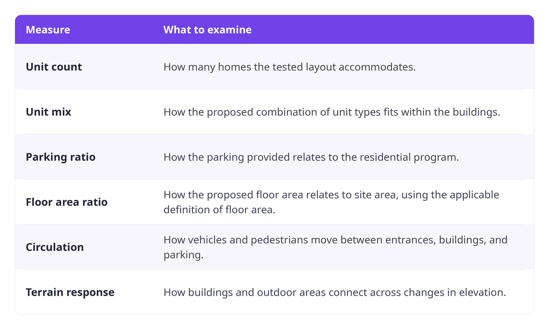
A higher unit count does not, by itself, establish the stronger development option. One scheme might accommodate more homes while requiring a more complicated parking or grading solution. Another might provide fewer homes with a layout that better supports the intended program.
This is where physical site planning connects with financial analysis in a feasibility study. Each option needs cost and revenue assumptions that reflect the design being evaluated.
For Site A and Site B, equal acreage is the common starting point. Their tested layouts reveal the differences that matter when deciding how to proceed.
Explore What Zenerate Can Do
Zenerate helps developers and architects explore site layouts, refine building configurations, and review development metrics during early planning.
Compare alternatives for a multifamily site, examine unit mix and parking, and review how buildings sit on terrain. These comparisons help your team identify promising options and the questions that need further investigation.
Explore Zenerate to see how it can support your next site feasibility study.